Day 6: Central and Northern Utah
The Pilot miniature halogen driving lights I had mounted on the crash-bar covers at the sides of my K1200LT had started playing tricks. When Boris, Paul, and I were leaving Grand Canyon National Park, the right lamp would not light. Then after riding a few miles, it miraculously came on. The next day while riding toward Moab, I noticed the left lamp was not lit. A bit later they were both on again. I decided it was probably time to replace the bulbs.
After gassing up the bike this morning in Green River, I stopped at an auto parts store I had noticed on the way into town the night before. Unfortunately, the only H3 bulbs they had in stock were the 100 watt ones -- much too hot for my small lamp housings. I had hoped to find a pair of 35 watt H3 bulbs for replacements, but those are difficult to find.
Finally, on my way out of town I noticed a NAPA auto store. They had 55 watt H3 bulbs. So I bought a pair of those and stashed them in my tail box. I then rode north on US highway 6/191 hoping that both of the old lamps would stay on. They did, at least this day.
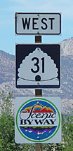
At Price, I turned south on Utah highway 10 and then west on Utah 31 at the town of Huntington. Boris had researched Utah highways before leaving on this trip, and he had read that Utah 31 from Huntington to Fairview, and then Utah 132 from Moroni toward Nephi and the Nebo Loop north to Payson were pretty rides. Unfortunately, he and Paul did not have time to come this way before returning to Minnesota. So I told him I would ride these roads and take pictures.
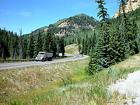
The scenery changes dramatically from the desert views along US 6/191 to the forested canyons of Utah 31. After several days of Nevada and Utah desert riding, this change was welcome. A major component of the traffic on highway 31 is large ore trucks. These are likely carrying coal from mines along the highway to a large coal-fired power plant about eight miles west of Huntington.
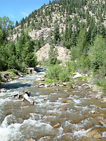
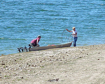
The babbling whitewater stream along the road gives way to earthen dams and reservoirs at the northwestern end of highway 31. Both appear to afford ample opportunities for fishing.
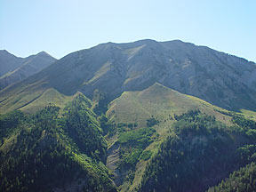
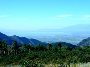
There is pretty farmland with lots of horses in the valley around Mt. Pleasant and Moroni (no photos), but the most dramatic scenery in this area was on the Nebo Loop that winds north to Payson. Here you see Mt. Nebo, the highest peak in the Wasatch range, and views of Utah Lake and Provo at the northern end of the loop.
After reaching Interstate 95 at Payson, I rode north to Provo where I took US highway 189 toward Heber City and Park City. I then followed Interstate 80 east, gassed up in Coalville, and rode the side road from there to Echo, where parts of the original Union Pacific grade for the transcontinenal railway (TR) are still visible. The past spring I had read Stephen E. Ambrose's excellent history of the building of the TR, "Nothing Like It in the World." The track followed roughly the route of Interstate 80 over Echo Summit. The railroad still follows this route, although newer tracks are now in use. Remnants of the old trackbed and bridges can still be seen.
After that, I rode Interstate 84 northwest to Ogden. This is also roughly the original route of the TR. I also hoped to visit the site at Promontory, north of the Great Salt Lake, where the tracks from the east and west were connected in May, 1869. But it was dusk when I reached Ogden, so this would have to wait until morning. I rode a bit farther, and stopped for the night in Brigham City.
Return to 2002 trip map.